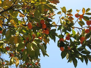
It's a bit of a hike to the west side of Seongbuk so we rode a bus so we could take a hike when we got there. It's a human being thing. No animal would think so irrationally.
 |
| Persimmon tree in west Seongbuk |
Seongbuk to the northwest of Hansung University Station is a good place to amble. It's historic, hilly, and picturesque. It's also a bit ritzier than our side of Seongbuk. There, we saw large tour groups out "ambling".
We do get tour buses unloading by us. People get off, dart into Dream Forest to go up in the observatory, and get back on the bus. Over on the other side of Seongbuk, there are walking tour loops mapped out. An entire afternoon or more can be spent ambling.
 |
| Walking tour group |
Now, quite often, the paper maps are nowhere to be found. In lieu is a sign with a hand drawn sketch or painting of a map. People don't even take the time to study it in an attempt to commit some of it to memory. They whip out their always present device of some sort and snap a picture of it. How handy. A portable, microscopic map. Although if I knew how to use my device that Stacey insists I carry, I could probably enlarge the tiny, electronic map. I'd rather just go on longing for the good old days of paper maps worn ragged after a long day's hard use.
 |
| No paper maps here |
Getting back to the ambling, we put in a few enjoyable hours. We funneled down alleyways, entered temples, and peered into windows of fine restaurants. We passed on the fancy food because nuts and mandarin oranges from the backpack always taste better than haute cuisine when out on the trail.
We marveled at the old fortress wall of Seoul. Originally constructed in the 1390's during the Joseon Dynasty, it surrounded the old city of Hanyang. When viewing such wonders, I always feel remorseful for the conscripted laborers who toiled to build such a monument to man's inability to coexist.
 |
| The fortress wall |
 |
| Trail marker |
The wall contained eight gates, one of which is the Hyehwamun Gate. We lingered a while at the Hyehwamun Gate because that's what tourists do. Although, in the definitive sense of the term, we're not really tourists. We just felt like tourists as the residents of west Seongbuk scurried past us going about their daily routine.
We saw well-dressed people carrying designer bags and wearing expensive shoes. How is it bags and footwear have become status symbols? When you think of it, both are of a very utilitarian nature. There again, attribute it to the foibles and vanity of man.
We stumbled upon a small public park called "Seongbuk Friendship Place" which celebrates Seongbuk's domestic sister cities and the many countries that have ambassador residences in Seongbuk. That was refreshing. It was uplifting to see a simple virtue so lacking in much of the world being acknowledged and praised here in our new backyard.
 |
| Friendship Place marker |
 |
| The flags of countries with ambassador residences in Seongbuk |
 |
| Friends lawn surfing on sheets of cardboard at Friendship Place |
No comments:
Post a Comment